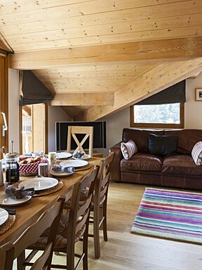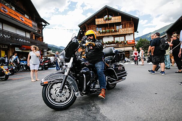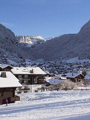
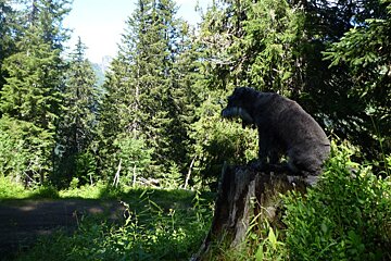
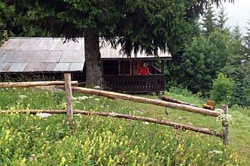
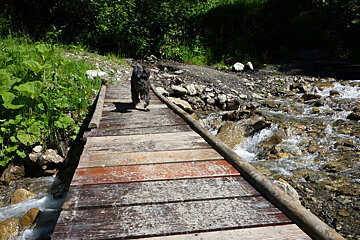
© Amy Marwick

© Amy Marwick
© Amy Marwick

© Amy Marwick
© Amy Marwick

© Amy Marwick
© Amy Marwick
© Amy Marwick

© Amy Marwick
© Amy Marwick
© Amy Marwick


Hiking In And Around Morzine
Keep your feet on the ground & explore some of Morzine's amazing scenery
For those of us not happy with throwing ourselves down steep mountain trails on two wheels, or clinging to cliff edges, hiking is a great way to explore the mountains and valleys of Morzine, whilst keeping two feet firmly on the ground.
Thanks to some spectacular trails and scenery, a day out hiking need not be any less thrilling or fulfilling. There are hundreds of forest loops, summits and ridges to investigate, and the chances are you’ll have them completely to yourself, with varying difficulties and lengths for every level of fitness. Here are four trails in and around Morzine to check out:
1. Col de Cou from Lac des Mines d’Or
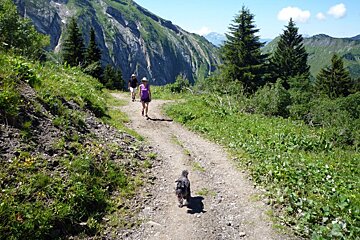
This is a brilliant walk for all the family that follows a wide, easy trail from the top of the Vallee de la Manche, surrounded by the striking Les Terre Maudits rock face on the right, and the Pointe de Ressachaux and Les Hauts Forts mountains on the left. There is a fair bit of vertical to ascend (530m to be exact) so allow time depending on the fitness of your group, however we managed this walk within three hours.
In days gone by this area was a prime location for smuggling, however now it is recognised for its bird migration. At the end of summer, between August and October, thousands of birds pass through the Col, many are caught and ringed by researches from the ornithological observatory, located nearby at the Col de Bretolet. Only half of the five million birds who fly over the pass each autumn will return the following spring.
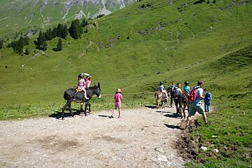
To access the walk take the road up the Vallee de la Manche, follow it all the way to the Lac des Mines d’Or where there is parking and a café. From the lake, take the track and continue to follow signs for Col de Cou. As we walked the first section to the chalets at Freterolle, we noticed a family large group who had rented donkeys for the children to ride up on, not a bad idea to keep kids entertained at the first hurdle!
The next crossroads you will reach is at Le Epingly. Here you can continue the forest walk and start to make a return journey, or make the final push to the top of the col for some spectacular views into Switzerland of the Dents Blanches and the Dents du Midi. On the day we got there however, it was somewhat of an anti climax as we found 40 others picknicking and taking photographs at the top. As this is one of the trails from walking guide, that you can pick up for free from the tourist office, it can get busy on sunny days, so I would recommend trying it during the week. From the top you can add an extra loop that will take you to the Col de Bretolet to see the bird observatory.
To get back down, retrace your steps to Le Epingly and continue along the track following signposts to Chardonniere. At the Refuge de Chardonniere we stopped for lunch, where eggs and cheese from the farm are top of the menu. The terrace makes for a great place to stop and relax in a lounger after a full-on hike.
2. Mont d’Evian to Lacs de Damoz des Moulins
For walks that are little off the well-beaten track head towards St Jean d’Aulps; just a ten-minute drive from the centre of Morzine, this village is surrounded by some great walks. Before reaching the centre, take the first right turning (Route du Peage) and follow signs for Mont d’Evian. Once through the little hamlet there is space at the side of the road to park. Do not continue up the road, instead take the last right turn in the village, and then bear right, along a slightly concealed path that leads you behind a chalet and up into the woods.
The first section of this route is a dramatic incline that takes you up through the forest along a narrow path, laced with tree roots. Continue along this path, bearing left at each intersection. Once through the tree line you will come to a wide open grassy plain, peppered with boulders, from here the route to the lake is marked with yellow flashes on the rocks.
You will pass by several small holdings, that despite being located well out in the sticks, are just as beautifully maintained as the wooden chalets far below. Once up on the ridgeline of La Grande Pare you will descend steeply down towards the lake at 1,609m. If that walk wasn’t enough to get the legs pumping then a march up to the Pic de la Corne summit at 2,084m certainly will be. Alternatively you can continue, as we did, back down towards Mont d’Evian passing through another beautiful hamlet, Les Fours de Cez, seemingly cut-off from the rest of the world. This route took around two and a half hours and was quite a demanding climb.
3. Graydon
On the other side of St Jean d’Aulps is the Grande Terche ski area, which offers many more hiking options. We drove as if heading towards the station, but turned off to the left before reaching it and headed for La Valletaz d’ en Haut, where there is space to park at the side of the road.
The signpost is marked with several options, but we took the route that leads to Joranloup. This trail climbs steeply up to 1,445m, Joranloup consists of three small wooden chalets. The third chalet was occupied when we passed by and offered cheese (presumably homemade) for sale.
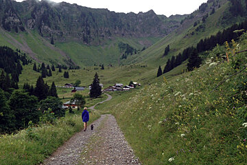
From Joranloup the path straddles the ridgeline, the forest dropping away steeply on either side. You will then come to a junction where you can either continue on up to the top of the Telecabine de la Grande Terche for a panorama of the ski area or begin the journey down towards Graydon. The stony track leads gently down towards the Graydon hamlet, where there is a café to stop off at on sunny days for a quick drink. The view up the valley towards the impressive Roc d’Enfer was concealed by thick cloud on the day we walked. This mountain, “Hell’s Rock” is a popular spot for ski touring in winter. From Graydon there are several routes up into the high pastures and rocky mountains, however we took the route back down to the road. This circuit took us two hours.
4. Les Gets
If you’ve skied the slopes of Les Gets and Morzine in winter, then strolling around the once white, now vivid green plains of the Campanule, Eglantine and Melezes runs makes for a novel walk. From Les Gets it’s very easy to get up into what once was the ski pistes, either by the Chavannes lift or take the road and park at the Les Chavannes chalets, there is also a bus.
From here there are a plethora of options, and as the mountains here are a little more forgiving, the walking is much less strenuous. From the car park we took the path bearing right under the Chavannes chairlift, past the beginner’s magic carpets. We stayed beneath the high ridge of La Tete de Grets and eventually passing under a second chairlift, all on good wide tracks with reasonably level walking. We climbed onto the ridgeline at the top of the Rosta and Grains d’Or chairlifts and continued around the bowl, with views stretching down to Les Gets and Mont Chery. We stopped for a well-earned lunch at La Croix Blanche at the top of the gondola, for traditional tasty Savoyard food. This circuit took two and a half hours, but there are plenty of alternative routes, just keep your eyes open for mountain bikers (although the mountain trails are very well constructed to avoid any walker biker collisions).
There are many different variations of these walks. It is certainly worth picking up the walking booklet from the tourist office, in addition to the Morzine topo map (IGN 3528 ETR, Randonnee et Plein Air, 1:25,000), which will give you a good idea of the many walking options, it is available at the bookstore on the Route de la Combe a Zore, just beyond the tourist office. There is a Cicerone guide, “Walking in the Haute de Savoie: North” which gives a good explanation of 30 walks south of Lake Geneva, including 15 within an hours drive of Morzine (see Amazon for the English version).